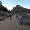
“An alternate route near the base of the Winsor Trail that connects with other trails to the south. ”
0.7
Miles1.1
KMSingletrack

Local Club: Santa Fe Fat Tire Society
Jan 12, 2024: We want to hear from you! 2024 Member Survey
Jan 11, 2024: Happy New Year Santa Fe mountain bikers!
Nov 9, 2023: 2023 Board of Directors Election
Land Manager: USFS - Santa Fe National Forest Office
 Winsor South Eight
15.4 mi 24.8 km • 2,705' Up 824.62 m Up • 2,712' Down 826.56 m Down


 Santa Fe, NM
 La Tierra Tortura
8.3 mi 13.4 km • 811' Up 247.07 m Up • 811' Down 247.13 m Down


 Santa Fe, NM
 Dead Dog Well Loop
20.9 mi 33.6 km • 1,733' Up 528.21 m Up • 1,733' Down 528.24 m Down


 El Rancho, NM
 Chips & Salsa
5.0 mi 8.1 km • 840' Up 256.18 m Up • 842' Down 256.6 m Down


 Pecos, NM
 Quemazon - Guaje Ridge - Cabra - Perimeter Loop
18.9 mi 30.4 km • 3,101' Up 945.28 m Up • 3,102' Down 945.37 m Down


 Los Alamos, NM
 Los Alalmos Pipe Line Guaje
16.8 mi 27.1 km • 2,894' Up 882.04 m Up • 3,019' Down 920.09 m Down


 Los Alamos, NM


0 Comments