Dogs Unknown

E-Bikes
Not Allowed
Description
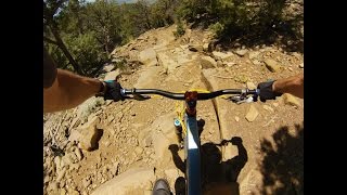
This two-track provides a 'bail-out' for those who don't want to ride the rocky El Nogal finish of the South Boundary Trail #164 and consists of doubletrack traverses followed by a steep descent with dozens of drainage berms that are ripe for the hucking.
From the log-drop intersection on the South Boundary Trail #164, head left (south) on the doubletrack logging road (closed to vehicles) to the rocky overlook. Make a hard right (back north) following the logging road to the descent. At the bottom, make a hard right up a steep, gravelly ascent to South Boundary Trail #164.
(To skip the steep connector climb between the Talpa Traverse and El Nogal, you can continue down to Hwy 585 and return via the shoulder to Hwy 64 and the trailhead.)
Traveled the other direction, the trail provides a leg-burning, lung-busting, relentless climb.
Note: Some maps may show a segment of the Ojitos Trail continuing northeast of the junction with the SBT. This trail is in rough condition and should be prepared for accordingly.
Contacts
Shared By:
Wheel Rider
with improvements
by J. Bella

 Continue with onX Maps
 Sign in with Facebook


 Intermediate/Difficult


3 Comments