
 Continue with onX Maps
 Continue with Facebook


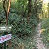
 Difficult

“A roller-coaster romp through Stub Stewart's western forest. ”


3.9
Miles6.2
KMSingletrack
 Difficult
Land Manager: Oregon State Parks
 Visitor Center Loop
6.6 mi 10.6 km • 926' Up 282.2 m Up • 935' Down 284.89 m Down

 Buxton to Stub Stewart MTB Trail
11.4 mi 18.3 km • 1,181' Up 360.07 m Up • 1,188' Down 362.13 m Down
 Banks, OR
Triple C to Step Creek Double Loop
Banks, OR
Triple C to Step Creek Double Loop
7.7 mi 12.3 km • 893' Up 272.09 m Up • 899' Down 273.96 m Down
Gales Creek - Southern Climb
13.8 mi 22.2 km • 2,058' Up 627.35 m Up • 2,059' Down 627.46 m Down
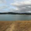
Henry Hagg Lake
13.6 mi 21.9 km • 889' Up 270.89 m Up • 891' Down 271.48 m Down
 Leif Erikson Road Plus
25.6 mi 41.2 km • 1,566' Up 477.34 m Up • 1,566' Down 477.44 m Down


 Minor Issues


0 Comments