
 Continue with onX Maps
 Continue with Facebook


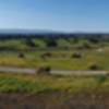
“A long gravel road loop extending into The Baylands with parallel singletrack trails along most of its length. ”


5.1
Miles8.3
KMDoubletrack

Land Manager: City of Palo Alto, CA - Open Space and Preserves
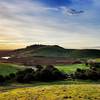
 Vista Slope
4.0 mi 6.4 km • 236' Up 71.91 m Up • 238' Down 72.46 m Down

 Coyote Hills
18.7 mi 30.2 km • 605' Up 184.27 m Up • 605' Down 184.37 m Down
Monte Bello-Stevens Creek Loop
17.3 mi 27.8 km • 2,390' Up 728.47 m Up • 2,387' Down 727.53 m Down

 Skeggs-n-Eggs
18.6 mi 30.0 km • 3,345' Up 1019.64 m Up • 3,343' Down 1018.94 m Down
Woodside, CA
El Corte Madera Open Space Loop
11.5 mi 18.4 km • 2,051' Up 625.02 m Up • 2,051' Down 625.04 m Down
Portola…, CA
Long Ridge Loop
6.0 mi 9.7 km • 689' Up 210.04 m Up • 689' Down 209.93 m Down
Saratoga, CA


1 Comment