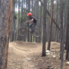
“An increasingly steep climb to a great, fast singletrack descent. ”
6.0
Miles9.7
KMSingletrack

 Colorado Trail: Kenosha Pass to Lost Creek Wilderness Boundary
13.1 mi 21.1 km • 1,690' Up 515.01 m Up • 1,689' Down 514.92 m Down


 Jefferson, CO
 Little French Loop
12.6 mi 20.3 km • 1,659' Up 505.65 m Up • 1,659' Down 505.53 m Down


 Brecken…, CO
 Baker's Tank and Aspen Alley loop from Breckenridge
11.5 mi 18.5 km • 1,482' Up 451.8 m Up • 1,457' Down 444.23 m Down


 Brecken…, CO
 Avalanche Sports Short Ride
5.9 mi 9.5 km • 966' Up 294.47 m Up • 969' Down 295.4 m Down


 Brecken…, CO
 Carter Park to Side Door
11.4 mi 18.3 km • 1,960' Up 597.53 m Up • 1,960' Down 597.55 m Down


 Brecken…, CO
 Breck Epic: Stage #3
42.1 mi 67.7 km • 6,938' Up 2114.77 m Up • 6,594' Down 2009.92 m Down


 Brecken…, CO


1 Comment