
 Continue with onX Maps
 Continue with Facebook


 Difficult

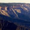
“A seldom used backcountry singletrack with great potential. ”


4.0
Miles6.4
KMSingletrack
 Difficult
Land Manager: USFS - White River National Forest Office
 Rifle Grand Hogback Complete
9.6 mi 15.5 km • 1,276' Up 389.06 m Up • 1,281' Down 390.39 m Down
 Rifle, CO
 Hogback Hot Lap
5.3 mi 8.6 km • 670' Up 204.18 m Up • 669' Down 203.92 m Down
Rifle, CO
 The Ute Trail
80.8 mi 130.0 km • 7,871' Up 2399.04 m Up • 8,295' Down 2528.4 m Down
Wulfsohn Figure 8 Loop
6.0 mi 9.6 km • 812' Up 247.52 m Up • 820' Down 249.82 m Down
 Flat Tops Out-and-Back
23.3 mi 37.6 km • 4,807' Up 1465.08 m Up • 4,806' Down 1464.92 m Down
Colorado Trail: The Entire MTB Route - IMBA EPIC
549.3 mi 884.0 km • 71,117' Up 21676.5 m Up • 69,664' Down 21233.6 m Down
Roxboro…, CO


0 Comments