
 Continue with onX Maps
 Continue with Facebook


 Intermediate

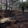
“A dirt USFS road from Hwy 11. ”


1.6
Miles2.6
KMDoubletrack
 Intermediate
Land Manager: USFS - Daniel Boone National Forest Office
 Big Bend Ride
11.7 mi 18.8 km • 627' Up 191.08 m Up • 627' Down 191.12 m Down

 Bald Rock Loop 2016
3.9 mi 6.3 km • 543' Up 165.52 m Up • 543' Down 165.42 m Down
Sheltowee Trace NRT: Sections 19, 20, 21
31.2 mi 50.1 km • 1,767' Up 538.68 m Up • 2,083' Down 635.01 m Down
Limestone Loop
19.8 mi 31.9 km • 1,512' Up 460.78 m Up • 1,510' Down 460.31 m Down
 Morehead, KY
 Kentucky Gravel Championship
63.5 mi 102.2 km • 4,949' Up 1508.49 m Up • 4,942' Down 1506.27 m Down
Annville, KY


 Bad / Closed


2 Comments