Dogs Unknown
E-Bikes
Unknown
Family Friendly
The route is relatively easy and flat. The views of the Lago Ponceña and Lago La Torre are nice. Plenty of shade along the route. These characteristics make this a family friendly trail.
Overview
A nice, easy and enjoyable ride along two man-made lakes (Lago Poncea and Lago La Torre) near the Collores Ward, Juana Diaz, PR area. The route is mostly flat along agricultural lands. There are plenty of sharp turns and quick drops that keep the route interesting. This ride is mostly singletrack with various sections that merge with municipal roads that serve local neighborhoods in the area.
Need to Know
There is a road crossing of Road PR-14 right after mile 0.7 of the trail. Horses and cattle may also be present along the trail. Near the end of the route, you have to bike a section of approximately 0.2 miles along the south side of Road PR-14 to get to the parking areas.
Description
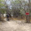
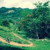
This easy to intermediate trail traverses along farmland that is currently used for horse and cattle grazing and a mango plantation. It is an enjoyable ride that provides views of two man-made lakes in the area (Lago Poncea and Lago La Torre) as well as sections of Ro Guayo. The route is mostly flat but has some sharp turns, several quick drops, and a few short and moderate climbs that should keep bikers of all skill levels amused. The route has plenty of shade and trees. There is a section along the east side of Lago La Torre with a series of zig-zagging ups and downs that is lots of fun.
The trail connects and merges with sections of municipal and local neighborhood access roads. Once you are familiar with the route, these connections allow for a few alternate routes. The trail is well-maintained and well-marked. The last stretch of the trail zigzags along Ro Guayo with a few drops and short hill sections. The terrain is very loose and rocky in this area; you can just stay on the paved municipal road that goes north along the west side of the river if you find this section of the trail unenjoyable.
The end of the trail connects with Road PR-14 at the bridge where the road intersects with Ro Guayo. Once you reach this point, you have to ride west for a short stretch of approximately 0.2 miles along the south side of Road PR-14 to get to the parking areas.
There is plenty of parking available in nearby areas. Note that the trail crosses Road PR-14 which is a very busy road. Fortunately the crossing point provides good visibility of both sides of Road PR-14. Be careful and cautious when making the crossing.
You'll see remnants of old structures, weirs, and even brick aqueduct channels and old water intake structures along the trail.
History & Background
Old farmland that was previously used for sugar cane. Currently it is being used for horse and cattle grazing and mango farms.
Shared By:
MTB Mojo
0 Comments