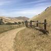
“A fire road from the town of Clayton to the Black Diamond Mines Preserve. ”
2.3
Miles3.7
KMDoubletrack

Land Manager: East Bay Regional Park District (CA)
 Mt. Diablo - Mitchell Canyon Ascent
13.4 mi 21.5 km • 3,018' Up 919.89 m Up • 3,018' Down 919.84 m Down


 Clayton, CA
 Nortonville & Black Diamond Trail Loop
8.0 mi 12.9 km • 1,643' Up 500.71 m Up • 1,641' Down 500.2 m Down


 Pittsburg, CA
 Creek Loop
6.8 mi 11.0 km • 777' Up 236.78 m Up • 779' Down 237.49 m Down


 Diablo, CA
 Old Borges Ranch Double Loop
6.5 mi 10.4 km • 756' Up 230.58 m Up • 752' Down 229.29 m Down


 Walnut…, CA
 Volvon Loop
9.3 mi 14.9 km • 1,222' Up 372.52 m Up • 1,222' Down 372.32 m Down


 Blackhawk, CA
 Tilden Park Inspiration Loop
8.7 mi 14.1 km • 828' Up 252.44 m Up • 848' Down 258.38 m Down


 Kensington, CA


0 Comments