Dogs Unknown

E-Bikes
Unknown

Starkweather Trail is seasonal, so make sure it's open beforehand. You can always do the other part of the ride, even if Starkweather isn't open. Contact the Inyo National Forest Mammoth Ranger District for current status of Starkweather - 760-924-5500
Overview
This tough ride is a "right of passage" for locals and visitors alike. But what goes up, must come down... right? The views at the top of
San Joaquin Ridge Trail are as magnificent as they get, and the singletrack on
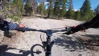
Starkweather Trail and
Mountain View Trail are top notch. If your lungs are up to the challenge, GET SOME!
Need to Know
High elevation. Lots of climbing. Weather can change in an instant, especially up on San Joaquin Ridge. Be prepared. Also, don't ride past the Wilderness Boundary on San Joaquin Ridge.
Description
This is a fairly easy route to navigate, since its a combo platter of three classic out-and-back trails:
Mountain View Trail,
Starkweather Trail, and
San Joaquin Ridge Trail.
Starkweather and San Joaquin Ridge are each 5 miles each, with a top elevation of 10,244' (the "double high five") and
Mountain View makes the stem of the Y (check out the map) Hence the weird name. With 3,600 of climbing over 22 miles, it doesnt matter what you call it its a mini epic thats worth every penny of sweat equity.
Click on the above links for specific details of each of the trails featured in this ride - but, in general, be prepared for lung-buster climbing with high-speed descents.
Mountain View provides stellar singletrack and doubletrack with open vistas and of course "mountain views," but also slinks its way through shady pine forests offering great places to take a snack break. It's very fun in both directions with climbing and descending mixed well, although you're definitely gaining elevation as you make your way to Minaret Vista from the Earthquake Fault.
Starkweather is one of the best singletrack descents anywhere. It's well-protected from the sun, and the dirt tends to stay tacky. Just be aware of hikers as you bomb down towards Starkweather Lake. The climb back out is a grunt, but if you find a good cadence and rhythm, you'll manage.
The final climb up San Joaquin is a doubletrack trail that is often used by motos. It doesn't have the same singletrack character as the other trails in this ride, but it gets you up to 360 degrees of splendid views. You definitely earn these views, with lung and sweat equity - nothing techy, just steep grades and heat during mid-day. The doubletrack descent is fast! It's mostly open so you can see very far ahead and pin it.
History & Background
The folks at Fat Bike Mammoth came up with this one over beers and high fives. The conversation included something like, "Who would wanna do this ride? and why?" -- The name evolved from there.
Contacts
Shared By:
Alan Jacoby

 Continue with onX Maps
 Sign in with Facebook


 Intermediate/Difficult

 4.5 (6)


1 Comment