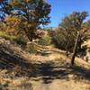
“A fun downhill with banked turns and rolling bumps. ”
0.6
Miles1.0
KMSingletrack

 Kern River Trail
16.8 mi 27.0 km • 2,163' Up 659.26 m Up • 2,902' Down 884.68 m Down


 Bodfish, CA
 Keyesville Classic
7.7 mi 12.4 km • 983' Up 299.54 m Up • 982' Down 299.19 m Down


 Lake Is…, CA
 Just Outstanding to Dutch Flat
13.2 mi 21.2 km • 642' Up 195.83 m Up • 4,933' Down 1503.47 m Down


 Alta Si…, CA
 Portuguese Pass
17.5 mi 28.2 km • 3,586' Up 1093.04 m Up • 3,587' Down 1093.28 m Down


 Alta Si…, CA
 Tehachapi Greenbelt Ride
10.3 mi 16.6 km • 536' Up 163.33 m Up • 536' Down 163.5 m Down


 Golden…, CA


0 Comments