 Race - Mar 22, 2020
Dogs Leashed

E-Bikes
Unknown

Dogs must be leashed.
Overview
Poinsett State Park was opened to cyclists in 2012 with the blessing of the park management. Since then, almost 10 miles of new trail have been added with more in the works.
Need to Know
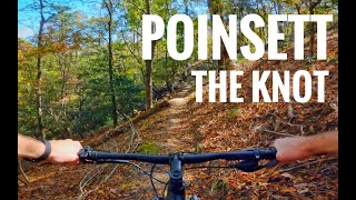
Trees are now blazed for trail navigation. The Knot has round metal tags with black arrows. Study the maps at the parking lot kiosk or ranger station.
Description
This course will wear you down over several laps! It is most commonly ridden counter clockwise. Get ready for 10.4 miles of singletrack fun! The course starts at the Old Levi Mill Pond dam and follows the Coquina and Knot Trails. At the end of the Knot, a short section of
Laurel Trail brings you to the parks paved road. You'll cross over and follow Splice trail to the left. Before the Splice bridge, turn right onto the
Whippoorwill Trail.
Whippoorwill will cross several dirt roads/doubletracks along the way to its terminus. At the end of Whippoorwill, continue across the Scout Trail and continue onto the
Cowasee Trail where the course will finish back at the parking lot. Look for more trails added in the future. This is the result of 3+ years of trail building in the park in preparation for the Southern Classic Race series.
The race is run by
mtpleasantvelo.org/
They also have a race team on FB
facebook.com/pg/mtpleasantv…
The Knot Race is part of the
southernclassic.bike/
Being held at
southcarolinaparks.com/poin…
History & Background
In 1936, Poinsett State Park was built by the Civilian Conservation Corps and is one of South Carolina 47 State Parks. The park is nestled in an area known as the High Hills of Santee, where the South Carolina Sandhills of the Midlands region meet the coastal plain region. Called the "Mountains of the Midlands," this mixed ecosystem yields a high degree of biodiversity and some of the most unique natural sightings in the park system, especially along the Palmetto trail which winds through areas of the park and the other 15 miles of trails within its boundaries.
Contacts
Shared By:
timothy fishburne

 Continue with onX Maps
 Sign in with Facebook


 Intermediate


1 Comment