
 Continue with onX Maps
 Sign in with Facebook


 Difficult

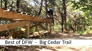
“BCWT's main loop. All others stem from Ranger. ”


5.4
Miles8.7
KMSingletrack
 Difficult
Local Club: Dallas Off Road Bicycle Association (DORBA)
 Cedar Hill State Park Loop
11.1 mi 17.9 km • 510' Up 155.44 m Up • 509' Down 155.09 m Down

 Cedar Hill, TX
 River Legacy Full Tour
7.5 mi 12.0 km • 104' Up 31.72 m Up • 106' Down 32.28 m Down
West Loop and Outer East Loop - Gateway Park
7.5 mi 12.1 km • 413' Up 125.91 m Up • 412' Down 125.52 m Down
 Trinity Trails: Trinity Main to West Fork
30.4 mi 48.9 km • 278' Up 84.68 m Up • 278' Down 84.68 m Down
 Northshore Trail
21.3 mi 34.3 km • 986' Up 300.59 m Up • 987' Down 300.95 m Down
Flower…, TX
Knob Hills MTB Trail
13.0 mi 21.0 km • 339' Up 103.42 m Up • 339' Down 103.19 m Down
Roanoke, TX


 All Clear


0 Comments