Dogs Unknown

E-Bikes
Unknown

Landowner permission required to ride these trails.
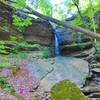
Description
This trail starts at the intersection with the
Worley Bottom Trail at the top of this hill. Instead of turning right to return on the Worley Bottom trail, turn left and continue along the top of a ridge that is the south boundary of the Ross Forests property marked with blue paint and an old fence. At a fence corner on the right, take a singletrack trail down the hill and follow it to a sharp left turn leading to a stream crossing.
The bridge that was here washed away so you must walk across the stream. Continue on the singletrack up two short but steep climbs to the top of the hill where the very old Giles Holt family cemetery has been identified and marked. Go a short distance to the right on an old logging trail and resume the singletrack to the left and follow it down a steep hill to another branch.
Right at the edge of the branch near a culvert under the highway, turn right and follow the winding trail down the branch to a wooden trail bridge. Across the bridge, take the left fork and climb another steep hill to where it intersects an old road.
Just as the road starts back downhill, take the singletrack to the left and continue on it to another wooden bridge. Continue on the wider trail up the hill to an intersection with an old logging road and loading area at the edge of a pine plantation. Go around the edge of the pines to where a large tree is blown down and take the trail down the hill to another wooden bridge over a stream that has become a beaver pond.
Continue on the singletrack around the bottom of a hill and along the Sulphur Spring branch to where it intersects the
Sugar Camp Hollow Trail at the Black Sulphur Spring.
Shared By:
John Ross

 Continue with onX Maps
 Continue with Facebook


 Intermediate


0 Comments