Continue with onX Maps
 Sign in with Facebook


Bishop
 CA
CA- High Sierra
- Bishop


Food & Drink
Recommended Routes in Bishop - 7
MTB Project is built by riders like you. Add Your Recommended Routes


 Intermediate/Difficult
Lower Rock Creek Trail
15.9 mi 25.6 km • 1,923' Up 585.98 m Up • 1,923' Down 586.05 m Down


 Very Difficult
Green Lake Loop
20.3 mi 32.7 km • 4,603' Up 1402.88 m Up • 4,595' Down 1400.51 m Down
 West Bi…, CA

 Intermediate
Westgard Pass Loop
8.3 mi 13.3 km • 1,143' Up 348.33 m Up • 1,145' Down 348.86 m Down
 Intermediate
Little Pine-McMurry Loop
9.5 mi 15.3 km • 1,522' Up 463.78 m Up • 1,537' Down 468.36 m Down

 Easy/Intermediate
Volcanic Tablelands Loop
24.3 mi 39.1 km • 1,308' Up 398.64 m Up • 1,308' Down 398.63 m Down


Trails in Bishop - 52
MTB Project is built by riders like you. Add Your Trails
|
1.1
mi
1.7
km
#1Owens Gorge Singletrack
Intermediate
Mammoth Lakes, CA
|
Intermediate
|
Mammoth Lakes, CA |
3
|
|
|
3.8
mi
6.0
km
#2Green Lake Trail (31E03)
Very Difficult
Big Pine, CA
|
Very Difficult
|
Big Pine, CA |
1
|
|
|
1.4
mi
2.3
km
#3Parchers Trail (31E04)
Very Difficult
Big Pine, CA
|
Very Difficult
|
Big Pine, CA |
1
|
|
8.3
mi
13.4
km
#4Waganobe Trail (32E01)
 Difficult
West Bishop, CA
|
Difficult
|
West Bishop, CA |
2
|
|
|
3.3
mi
5.3
km
#5Poleta Ridge
Very Difficult
Bishop, CA
|
Very Difficult
|
Bishop, CA |
3
|
|
|
35.4
mi
57.0
km
#6White Mountain Road
Intermediate
Big Pine, CA
|
Intermediate
|
Big Pine, CA |
4
|
|
|
2.0
mi
3.3
km
#7Wagon Wheel Trail
Intermediate/Difficult
West Bishop, CA
|
Intermediate/Difficult
|
West Bishop, CA |
9
|
|
|
9.7
mi
15.6
km
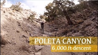
#8Poleta Canyon
Difficult
Bishop, CA
|
Difficult
|
Bishop, CA |
2
|
|
|
2.2
mi
3.5
km
#9Black Canyon Trail
Difficult
Bishop, CA
|
Difficult
|
Bishop, CA |
1
|
|
|
3.7
mi
5.9
km
#10Little Pine Creek (9S102)
Intermediate
Big Pine, CA
|
Intermediate
|
Big Pine, CA |
1
|
Photos of Bishop - 57
MTB Project is built by riders like you. Add Your Photos