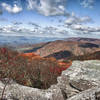
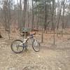
“Shuttle this road to the ridge without climbing Horse Nettle and see some nice views by the power lines on the ridge. ”
0.9
Miles1.5
KMDoubletrack

Local Club: Poverty Creek Trails Coalition (PCTC)
 Pandapas Pond "Easy" Loop
11.1 mi 17.9 km • 1,436' Up 437.78 m Up • 1,436' Down 437.57 m Down


 Blacksburg, VA
 Mcdonald's to Gateway Loop
6.9 mi 11.1 km • 1,029' Up 313.62 m Up • 1,050' Down 319.91 m Down


 Prices…, VA
 Upper Bald Knob Loop
3.1 mi 5.0 km • 792' Up 241.47 m Up • 791' Down 241.09 m Down


 Pembroke, VA
 Upper Left Loop
9.9 mi 16.0 km • 1,317' Up 401.47 m Up • 1,316' Down 400.97 m Down


 Hollins, VA
 Bikepacking Pulaski to Damascus
122.9 mi 197.8 km • 9,173' Up 2795.81 m Up • 9,179' Down 2797.78 m Down


 Pulaski, VA
 Potts Mountain Jeep Trail Loop
18.1 mi 29.1 km • 2,475' Up 754.49 m Up • 2,472' Down 753.5 m Down


 New Castle, VA


1 Comment