Use onX Backcountry to explore the terrain in 3D, view recent satellite imagery, and more.
Now available in onX Backcountry Mobile apps!
For more information see this post.
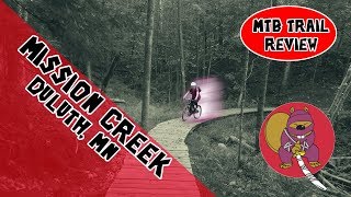
“Mostly flat, this doubletrack has some gentle rolling hills making it a good gateway route for Mission Creek.
”
ADA Accessible
This route is a limestone gravel path meeting ADA/ABA accessibility requirements for a recreational trail. It has a firm and stable surface with a few short hills that are up to 8% slope.
Family Friendly
Adjacent to the playground and picnic shelter this trail makes a good half-mile option for your strider bike riders.
Description
Chambers Grove was significantly impacted by the June 2012 flood. The City of Duluth obtained $100,000 through a Minnesota Lake Superior Coastal grant to educate and inform visitors about the area history, riparian habitat, and flood control and recovery.
An interpretive 0.5-mile loop with signage through the riparian woodland west of the open park space will provide access to the natural area and historical sites such as an abandoned quarry and the first rail bed build in Duluth.
The trail replaces the social trails not winding throughout the riparian zones, protecting habitat and water quality while providing access to nature and history enthusiasts.
Moderately steep. Uneven terrain with small rocks or roots.
Sizable rocks & roots. Steep sections.
Steep. Some technical terrain and limited alternate lines.
Very steep. Technical terrain with no alternate lines.
Difficulty Rating
Average from 1 vote:
Easy
Your Rating
Virtual Tour of Chambers Grove Interpretive Trail
We use cookies to improve your browsing experience, to show you
personalized content, and for statistical purposes. By continuing
to navigate our website, you accept our use of cookies. Read our
Privacy Policy to learn more.
0 Comments