Not a lot of singletrack getting out of Denver and to the base of the Divide, but lots of climbing. It's a big day with a loaded bike for most people. 5,500 feet of climbing in 45 miles, most of it in the last 25 miles.
Water is generally available if you bring a filter as the route follows numerous creeks.
The one chance for resupply after you leave Golden and before Winter Park was at Rollinsville, but it's closing. There is one restaurant along the way, The Last Shot, just south of Rollinsville.
Starting at Confluence Park behind REI, we head south on the South Platte
River Trail a bit so we can swing past Elitch Gardens amusement park and through Mile High Stadium with its rampaging mustang tableau and oversize football gear sculptures. Then, head past scenic Sloan's Lake for views of the mountains across the water, up Tennyson Street through its hip cultural district, past Berkeley Lake Park, and under I-70 at Sheridan Boulevard. Crossing here is a bit tricky. Best to stick to the east sidewalk, then cross Sheridan on the north side of the freeway at the light.
From there, we jog over to Inspiration Point Park with its fantastic overlooks of the entire Front Range where you can see exactly what you're in for, before dropping out the north side of the park along the steps to residential streets down to
Clear Creek Trail.
Following
Clear Creek Trail west for 12 miles to takes you to Golden. You pass through numerous parks and suburbs, then a gold panning area before the long march of the massive Miller-Coors facilities begins. After you skirt the flank of North Table Mountain, you arrive at an intersection with the
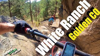
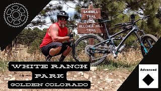
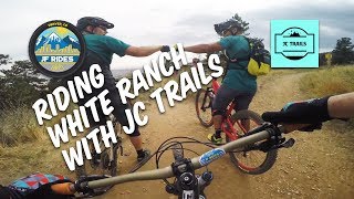
Tucker Gulch Trail. Turn right under the bridge and head north till you pass under CO-93 and arrive at the Golden Gate Canyon parking area. From there, head north across Golden Gate Canyon Road on Catamount Drive, then turn left onto Pine Ridge Road. Follow this semi-rural road north till it ends at the lower trailhead for White Ranch Open Space. From here, you'll climb the
Belcher Hill singletrack over 1,700 feet to the upper trailhead. With a loaded bike, there will likely be some pushing on
Belcher Hill.
Leave White Ranch west on the paved
Belcher Hill Road, then turn right when it intersects with Drew Hill Road. This leads north, quickly turns to dirt, and climbs to Drew Pass before dropping steeply with multiple switchbacks into the Ralston Creek drainage and Golden Gate State Park. Here the road becomes rough pavement and follows the creek upstream. It is a low traffic road providing access to several state park trailheads.
If you love climbing (pushing) steep, technical, eroded singletrack with a loaded bike, turn right at the first trailhead and join
Mountain Lion Trail, following the different singletracks to the top of the park. A couple of our riders were already in trouble with the elevation and climbing, so we continued up the pavement to Golden Gate Canyon Road, turned right, and then took another right onto Mountain Base Road. This is a park access road, and paved very nicely. It is also very steep, in places hitting a 19% grade, with lots of beautiful switchbacks and views.
After a ton of climbing, you come out at the top at Gap Road. If you turn right on this dirt beauty, you can take a 0.5 mile side trip to Panorama Point overlook with sweeping views of the Continental Divide. Turning left takes you rolling down to the Peaks to Peaks Highway (CO-119). Turning right here begins a fantastic descent on sweeping pavement with wide shoulders and amazing views. If you're feeling a bit peckish, at South Beaver Creek Road is The Last Shot family restaurant. After a cold summer thunderstorm and the long descent, we stopped in to drink warm things and get the feeling back in our hands.
Continuing north on the Peaks to Peaks, the scenery and pavement continues. After the twisting descent into Rollinsville you reach Tolland (East
Portal) Road after you cross South Boulder Creek. Turn left onto this dirt road and in a few miles, the Indian Peaks Traverse joins you from the right at Forest Service Camp Road (105). You're now on the Traverse! We continued on Tolland Road to County 4-N and found a dispersed campsite just up the hill there, but you can continue on to Rollins Pass Road and proceed with the Traverse as far as you legs will carry you. For us, this was the first day of a 7 day Denver-to-Denver bikepacking loop and we wanted to cross Rollins Pass the next morning before the afternoon thunderstorms rolled in.

 Continue with onX Maps
 Sign in with Facebook


 Intermediate/Difficult


 Highline, Powerline, Unnamed Creek, Tollgate, and Cherry Creek Trail
 North Table Figure 8: Best of the Descents
 Ape' Ney (Apex to Chimney)
 North Table Loop


1 Comment