MTB Project Logo

BCT climbs into more challenging terrain.


Your Rating: Rating Rating Rating Rating Rating      Clear Rating
Your Difficulty:
Your Favorites: Add To-Do · Your List
Zoom in to see details
Map Key

7.5

Miles

12.1

KM

Singletrack

2,453' 748 m

High

1,940' 591 m

Low

649' 198 m

Up

766' 234 m

Down

4%

Avg Grade (2°)

12%

Max Grade (7°)

Dogs Unknown

E-Bikes Allowed

Need to Know

Dry camping is available along West Gasline Road in numerous flat spots. The road becomes progressively rougher to the west. Also at Table Mesa Trailhead, where there is a large BLM area with many dispersed sites. There are no amenities whatsoever at either location, so bring water and leave no trace.

Description

This section is a bit more advanced than BCT: Carefree Highway to New River to the south, with steeper grades, chunkier trail tread, and some sections of steep cross-slope.

The section starts at W Gasline Road and heads north as wide track shared with OHVs.

After a short distance you have two options: Boy Scout Loop West which is mostly road and the east route which is good singletrack.

The trail climbs steadily to a saddle at 1.9 miles, then descends the other side on chunky but not excessive grades. Nearing the bottom the trail touches a road (9949) then turns sharply towards the wash. Just to the west along the road is an old shed in a state of advanced decrepitude. Uphill is an unnamed spring, so it’s possible there was a homestead here.

Crossing the arroyo through a small oasis, the trail rises gradually in a broad valley. At 3.8 miles (3.6 from the north) the trail crosses 9950. This point is less than one mile from the frontage road, so it is an alternate access or bailout point.

The trail climbs again to the high point of this section, then descends more steeply to the Table Mesa Trailhead. This section has loose rocks and some sections of strong cross-slope so use care as you descend.

Contacts

Shared By:

John Geronimo with improvements by Michael Weiss

Trail Ratings

  4.0 from 2 votes

#12953

Overall
  4.0 from 2 votes
5 Star
50%
4 Star
0%
3 Star
50%
2 Star
0%
1 Star
0%
Trail Rankings

#368

in Arizona

#12,953

Overall
35 Views Last Month
1,010 Since Dec 23, 2018
Difficult Difficult

0%
0%
0%
50%
50%
0%

Photos

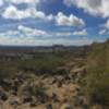
Zig-zagging up to the high point of this section
Dec 23, 2018 near New River, AZ
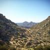
Looking north towards the general area of the Table Mesa trailhead
Dec 23, 2018 near New River, AZ
Flow trail section with gravel tread
Dec 23, 2018 near New River, AZ
Oasis at wash crossing
Dec 23, 2018 near New River, AZ
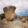
This section has sections of strong cross-slope
Dec 23, 2018 near New River, AZ

0 Comments

Weather


Current Trail Conditions

Unknown
Add Your Check-In

Check-Ins

none
Welcome

Join the Community

Create your FREE account today!
Already have an account? Login to close this notice.

Get Started