
 Continue with onX Maps
 Continue with Facebook


 Intermediate/Difficult

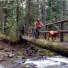
“Rolling riding through open, recovering post-fire habitat. ”


3.8
Miles6.1
KMSingletrack
 Intermediate/Difficult
Local Club: LUMBR (Land of Umpqua Mountain Bike Riders)
Land Manager: USFS - Umpqua National Forest Office
 Yellow Jacket Loop
13.3 mi 21.3 km • 2,319' Up 706.68 m Up • 2,313' Down 705.13 m Down
 Moon Point Loop
19.0 mi 30.6 km • 3,346' Up 1019.9 m Up • 3,351' Down 1021.49 m Down
 Oakridge, OR
 North Umpqua - IMBA EPIC
71.8 mi 115.5 km • 4,143' Up 1262.73 m Up • 7,880' Down 2401.78 m Down
Crater…, OR
Crawfish+Knott
15.7 mi 25.3 km • 3,611' Up 1100.64 m Up • 3,611' Down 1100.51 m Down
Culp Creek, OR
Middle Fork Willamette Trail #3609
31.4 mi 50.5 km • 282' Up 85.96 m Up • 4,050' Down 1234.53 m Down
Crater…, OR


0 Comments