
 Continue with onX Maps
 Continue with Facebook


 Intermediate/Difficult

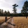
“A remote, rugged, beautiful backcountry adventure! ”


15.6
Miles25.1
KMSingletrack
 Intermediate/Difficult
Local Club: Silver City Cycling
Land Manager: USFS - Gila National Forest Office
 Burnt Cabin Flats to Chloride
28.3 mi 45.6 km • 1,794' Up 546.71 m Up • 3,309' Down 1008.49 m Down
 Faywood, NM
 CDT/GET North from Mud Hole, NM
31.1 mi 50.0 km • 1,608' Up 490.18 m Up • 1,606' Down 489.44 m Down
 Rio Mimbres Loop
22.5 mi 36.2 km • 1,512' Up 460.94 m Up • 1,511' Down 460.59 m Down
Santa C…, NM
Signal Peak to Sapillo Campground
21.3 mi 34.3 km • 2,494' Up 760.1 m Up • 2,494' Down 760.1 m Down
 Arenas…, NM
Little Cherry Creek to Sapillo Shuttle
Arenas…, NM
Little Cherry Creek to Sapillo Shuttle
20.3 mi 32.7 km • 2,750' Up 838.2 m Up • 3,140' Down 957.04 m Down
Arenas…, NM


0 Comments