
 Continue with onX Maps
 Continue with Facebook


 Intermediate


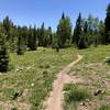
“A fast and fun descent into the Dry Creek drainage. ”


3.9
Miles6.3
KMSingletrack
 Intermediate
 Buck and Aspen Combo
17.6 mi 28.2 km • 1,858' Up 566.19 m Up • 1,853' Down 564.81 m Down
 Whole Uncolada
20.4 mi 32.8 km • 773' Up 235.75 m Up • 3,744' Down 1141.12 m Down
 Little Lower Spring Creek Loop
11.1 mi 17.9 km • 1,122' Up 341.89 m Up • 1,122' Down 342.08 m Down
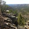
Dry Creek Canyon Trails
13.7 mi 22.1 km • 1,622' Up 494.42 m Up • 1,616' Down 492.46 m Down
 Nucla Range Loops
3.5 mi 5.7 km • 457' Up 139.34 m Up • 458' Down 139.62 m Down
Thunder Trails
20.2 mi 32.4 km • 983' Up 299.54 m Up • 985' Down 300.31 m Down


0 Comments