This has been hidden from our maps to prevent overlap with existing trails, or because
our research has found there is no legal access.
Dogs Unknown

E-Bikes
Unknown
Features
Commonly Bikepacked

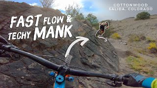
Riding the 14ers along this loop is a fringe activity that, as of the summer of 2016, was permitted by the US Forest Service on all the peaks included on this route. Continued access by mountain bike is tenuous, so it is of paramount importance that mountain bikers exercise the utmost respect and kindness toward hikers and horse riders on these trails, and practice conscious mountain Leave No Trace skills.
Section Of
Description
After following the popular Colorado Trail to Leadville, the route begins to loop back south through country that sees far fewer bikepackers. The toughest, tallest climb on the main loop gains Mosquito Pass through the heart of the still-active Leadville Mining District on steep, loose mining roads.
On the east side of the pass sits the much smaller town of Alma and access to Mounts Cameron and Lincoln to the north. Beyond Alma, the route descends gradually on a paved bike path toward Fairplay before turning south through rural neighborhoods and 4x4 roads to Fourmile Creek. To the west sits Mt. Sherman, the final 14er on this loop.
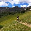
Mounts Cameron and Lincoln can be ridden from Alma as a loop, best done clockwise. Most of this loop follows rough mine roads that top out at nearly 14,000 feet. From there, gaining the summit of Cameron is just a short jaunt off the main ridge. Summiting Mt. Lincoln requires a bit of scrambly hike-a-bike, but the huge views are well worth the effort. The descent off Lincoln is steep, and loose to start, but after a few hundred feet, you’ll join another mine road and descend that all the way back down to the main valley far below. Mt. Sherman sits at the end of a graded dirt road, and it is easily rideable up to nearly 13,000 feet. From there, the trail to the summit is almost entirely on scree and talus, making for nearly continuous hiking up and rather treacherous riding down.
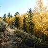
South of the Fourmile Creek Road, the main loop follows a series of 4x4 tracks, a bit of quad trail, passes through one last rural neighborhood, and then joins a series of primitive backcountry trails. The seldom-traveled Sheep Creek, Tumble Creek, and Salt Creek trails are all quite rideable, water is relatively abundant, and the views looking east into South Park are unparalleled.
The final 40 miles of the route is primarily dirt road descending from Buffalo Peaks and then traversing the rugged landscape to the south before joining singletrack for the final long descent into Salida. The dirt roads first pass through Chubb Park, an area to avoid if wet due to the clay-rich roadbeds. After crossing Highway 285 and the final reliable water source on the route, the graded road climbs intermittently and becomes rougher. The high point on the road is Aspen Ridge, and from there, the route begins the up-and-down descent toward Salida. The final section of the route follows ~10 miles of singletrack right to downtown.
Contacts
Shared By:
Bikepacking Roots

 Continue with onX Maps
 Continue with Facebook


 Intermediate


0 Comments