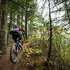
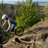
“A doubletrack to singletrack climb around the south flank of Larrabee State Park. ”
2.4
Miles3.9
KMSingletrack

Local Club: WMBC - Whatcom Mountain Bike Coalition
Land Manager: WSP - Larrabee State Park
 Chuckanut Ridge Trail Descent
6.0 mi 9.6 km • 253' Up 77.05 m Up • 2,061' Down 628.13 m Down


 Bellingham, WA
 Double Diamond to Double Down
2.4 mi 3.9 km • 6' Up 1.85 m Up • 1,684' Down 513.19 m Down


 Bellingham, WA
 Evolution, Unemployment Line, and Atomic Dog Descent
7.4 mi 11.9 km • 1,153' Up 351.58 m Up • 1,162' Down 354.06 m Down


 Bellingham, WA
 Lily and Lizard Lake Loop
7.2 mi 11.6 km • 1,445' Up 440.37 m Up • 1,445' Down 440.31 m Down


 Bow, WA
 Golden Spike, SST, and Back Door Loop
5.6 mi 9.0 km • 940' Up 286.4 m Up • 966' Down 294.29 m Down


 Bellingham, WA
 Little Mountain Park Ride
6.4 mi 10.2 km • 758' Up 230.97 m Up • 757' Down 230.87 m Down


 Big Lake, WA


0 Comments