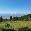
“The longest trail at Munger Mountain with awesome views of the Teton Mountain Range. ”
7.8
Miles12.5
KMSingletrack

Local Club: Friends of Pathways (FOP)
Jun 16, 2023: Trail Conditions 6-16-23
Jun 10, 2023: Trail Conditions for 6-9-23
Jun 2, 2023: Trail Conditions for 6-2-23
Land Manager: USFS - Bridger Teton National Forest Office
 Munger Mountain Loop
8.5 mi 13.6 km • 1,410' Up 429.78 m Up • 1,410' Down 429.85 m Down


 Rafter…, WY
 Big Munger Mountain Loop
17.4 mi 28.1 km • 3,761' Up 1146.37 m Up • 3,771' Down 1149.52 m Down


 Rafter…, WY
 Cache-Game Loop
25.0 mi 40.2 km • 2,581' Up 786.74 m Up • 2,595' Down 790.89 m Down


 Jackson, WY
 Shadow Mountain Loop
7.4 mi 12.0 km • 1,422' Up 433.37 m Up • 1,428' Down 435.21 m Down


 Jackson, WY
 Grove Creek, Red Creek, Drake Creek Loops
15.4 mi 24.8 km • 2,971' Up 905.71 m Up • 2,974' Down 906.36 m Down


 Victor, ID
 South Fork of Horseshoe to Mahogany
9.7 mi 15.6 km • 1,589' Up 484.25 m Up • 1,810' Down 551.77 m Down


 Driggs, ID


2 Comments