
 Continue with onX Maps
 Continue with Facebook


 Intermediate/Difficult

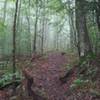
“A super fun trail that is basically one large technical section with lots of roots and rocks. ”


1.4
Miles2.2
KMSingletrack
 Intermediate/Difficult
Land Manager: Snowshoe Resort
 Silver Creek Route
8.0 mi 12.9 km • 1,002' Up 305.41 m Up • 1,033' Down 314.75 m Down


 Mower Basin Flow Route
6.3 mi 10.1 km • 510' Up 155.6 m Up • 515' Down 156.95 m Down
Elkins, WV
 Dogway Glades Loop
23.7 mi 38.2 km • 1,441' Up 439.31 m Up • 1,454' Down 443.08 m Down
Eagle Camp Loop
13.8 mi 22.2 km • 1,308' Up 398.77 m Up • 1,314' Down 400.46 m Down
 Spruce Knob to Seneca Creek - IMBA EPIC
17.6 mi 28.4 km • 1,944' Up 592.49 m Up • 1,950' Down 594.21 m Down
Pisgah Approved
4.6 mi 7.4 km • 1,121' Up 341.58 m Up • 1,119' Down 340.96 m Down


0 Comments