Dogs Unknown

E-Bikes
Unknown
Overview
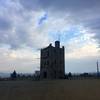
After a tough climb, you are rewarded with a fun descent and some scenic views along the way.
Description
The ride begins with the climb toward Austin Summit. The climb continues to the south along the ridge of the Toiyabe Range. Turn left shortly after the downhill begins. (Watch the trail signs–several trails share the ridge.) The descent can be tricky due to the vegetation. The trail follows an intermittent creek into a woodland of juniper and scattered aspen groves. Heading north out of Cahill Canyon, the trail joins Highway 50 briefly. Go left on the highway but watch for the right turn onto a two-track heading north. This track heads toward a small canyon, a left turn with occasional stream crossings, and a final climb back to Austin Summit. The descent back to the town of Austin is fast and fun.
Contacts
Shared By:
Spencer Whitman

 Continue with onX Maps
 Continue with Facebook


 Intermediate/Difficult


1 Comment