
 Continue with onX Maps
 Continue with Facebook


 Difficult

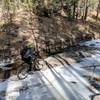
“A short ride that is occasionally rocky and steep that ends with an amazing view. ”


1.4
Miles2.3
KMSingletrack
 Difficult
Land Manager: New Mexico State Parks - City of Rocks State Park
 Big Tree Loop
11.6 mi 18.7 km • 745' Up 227.01 m Up • 740' Down 225.57 m Down

 Rio Mimbres Loop
22.5 mi 36.2 km • 1,512' Up 460.94 m Up • 1,511' Down 460.59 m Down
Santa C…, NM
 Fluorite Loop
16.6 mi 26.7 km • 1,267' Up 386.05 m Up • 1,266' Down 385.87 m Down
 Boston Loop
5.8 mi 9.3 km • 430' Up 131.2 m Up • 432' Down 131.6 m Down
 Bear Mountain Mayhem
27.4 mi 44.0 km • 2,867' Up 873.79 m Up • 2,866' Down 873.52 m Down
Silver…, NM
Signal Peak Challenge Long Loop
22.4 mi 36.0 km • 2,672' Up 814.55 m Up • 2,682' Down 817.47 m Down
Arenas…, NM


0 Comments