MTB Project Logo

A technical climb/descent into and out of Bear Valley.


Your Rating: Rating Rating Rating Rating Rating      Clear Rating
Your Difficulty:
Your Favorites: Add To-Do · Your List
Zoom in to see details
Map Key

8.5

Miles

13.7

KM

Singletrack

8,445' 2,574 m

High

6,438' 1,962 m

Low

1,875' 571 m

Up

2,155' 657 m

Down

9%

Avg Grade (5°)

34%

Max Grade (19°)

Dogs Off-leash

E-Bikes Unknown

Description

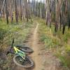
The area surrounding this trail was burned in 2006 during the Red Mountain Fire, so you may encounter many down trees if ridden early in the season. The trail is usually cleared every year, so your way should be fully opened by mid July or August.

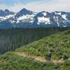
There will be some steep sections along the creek to navigate, but it will be worth it for the blazing fast downhill on the way down. Once you reach the summit, you'll descend and then it will be important to stay right, otherwise you'll end up descending the Gates Creek Trail. You'll ride along the ridgeline above fir creek before finally dropping into the creek. From here you'll have some more twists and turns before crossing the creek and reaching the trailhead.

Starting at the Fir Creek trailhead, the trail starts out quite mellow, then crosses the creek (Fir Creek) in about 0.5 miles, at which point some seriously steep and loose (mostly unrideable) switchbacks start. The steepness and looseness continue for about another 2.5 miles (this section goes up a spur ridgeline and is not "ridgeline along Fir Creek," but is technically along a tributary) which is mostly hike-a-bike due to largely 10+% grade with pitches above 20% and loose, incised and rocky conditions.

There is a short stretch of rideable trail once on top of the ridge before the final push up and over the last pitch before meeting Wyoming and Gates Creek trails. At this point, I was so tired from my earlier ride (Lola CR from Bear Valley Road) and after this roughly 2 miles of bike pushing (which I don't mind when I know it's coming), I returned to the Fir Cr trailhead where I left my vehicle. The descent, like the climb, is very challenging and should only be attempted by very experienced riders.

Using the road FS579 you can make this trail into a loop. This means you'll climb some of the uphill on FS579 and some along Wyoming Creek.

Contacts

Shared By:

Chris Cook with improvements by Stephen Kramer

Trail Ratings

  4.0 from 1 vote

#15952

Overall
  4.0 from 1 vote
5 Star
0%
4 Star
100%
3 Star
0%
2 Star
0%
1 Star
0%
Trail Rankings

#730

in Idaho

#15,952

Overall
1 Views Last Month
152 Since Dec 31, 2015
Difficult Difficult

0%
0%
0%
0%
100%
0%

Photos

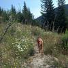
Stanley out on Wyoming-Fir Creek Trail.
Jun 29, 2016 near Cascade, ID

0 Comments

Weather


Current Trail Conditions

Unknown
Add Your Check-In

Check-Ins

none
Welcome

Join the Community

Create your FREE account today!
Already have an account? Login to close this notice.

Get Started