Use onX Backcountry to explore the terrain in 3D, view recent satellite imagery, and more.
Now available in onX Backcountry Mobile apps!
For more information see this post.
“The main access for a shuttle, or climbing access to various trailheads.
”
The Forest Service does not recommend trailers in this area.
Description
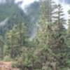
Long gravel road providing access to the Lower Dungeness and Gold Creek Trailhead (via Road FS-2870-230). Be aware that there is limited parking at the Three O'Clock Ridge Trailhead, and at the Upper Dungeness Trailhead (requires fee), as well as at the Tubal Cain Trailhead.
Moderately steep. Uneven terrain with small rocks or roots.
Sizable rocks & roots. Steep sections.
Steep. Some technical terrain and limited alternate lines.
Very steep. Technical terrain with no alternate lines.
Difficulty Rating
Average from 1 vote:
Intermediate
Your Rating
Virtual Tour of Road FS2870
We use cookies to improve your browsing experience, to show you
personalized content, and for statistical purposes. By continuing
to navigate our website, you accept our use of cookies. Read our
Privacy Policy to learn more.

 Continue with onX Maps
 Continue with Facebook


 Intermediate


0 Comments