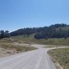
“A gravel trial best used to access the River Trail. ”
0.9
Miles1.4
KMDoubletrack

 Spring Hollow Ride
17.1 mi 27.6 km • 3,918' Up 1194.09 m Up • 3,917' Down 1193.93 m Down


 North L…, UT
 Ricks Canyon to Steel Hollow
12.1 mi 19.4 km • 2,270' Up 691.96 m Up • 2,270' Down 691.86 m Down


 North L…, UT
 White Pine to Bunchgrass
12.1 mi 19.4 km • 858' Up 261.38 m Up • 2,618' Down 797.98 m Down


 Richmond, UT
 Blind Hollow
6.0 mi 9.7 km • 535' Up 162.97 m Up • 2,713' Down 826.81 m Down


 Richmond, UT
 Hodges Canyon Shuttle
5.8 mi 9.4 km • 94' Up 28.51 m Up • 1,803' Down 549.59 m Down


 Richmond, UT
 Eden Epic
46.2 mi 74.3 km • 8,271' Up 2520.87 m Up • 8,647' Down 2635.51 m Down


 Liberty, UT


0 Comments