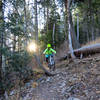
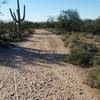
“A short, very rocky techy connector trail. ”
1.2
Miles1.9
KMSingletrack

Local Club: Sonoran Desert Mountain Bicyclists
Land Manager: USFS - Coronado National Forest Office
 Aspen Meadow & Aspen Draw
7.9 mi 12.7 km • 1,562' Up 476.2 m Up • 1,562' Down 476.24 m Down


 Oracle, AZ
 Golder Ranch Trail System
11.1 mi 17.8 km • 1,123' Up 342.37 m Up • 1,122' Down 341.95 m Down


 Catalina, AZ
 Honeybee Canyon Loop
19.5 mi 31.4 km • 865' Up 263.7 m Up • 863' Down 263.12 m Down


 Catalina, AZ
 Ridgeline Loop
12.2 mi 19.6 km • 1,492' Up 454.87 m Up • 1,492' Down 454.77 m Down


 Catalina, AZ
 Arthur Pack Loop
4.0 mi 6.4 km • 117' Up 35.65 m Up • 118' Down 35.92 m Down


 Tortolita, AZ
 Greasewood Park
2.7 mi 4.4 km • 156' Up 47.64 m Up • 154' Down 47.09 m Down


 Flowing…, AZ


1 Comment