
 Continue with onX Maps
 Continue with Facebook


 Intermediate

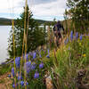
“A useful, Keystone/Summit Cove connector trail to connect Soda Creek and Aqueduct trails. ”


1.1
Miles1.8
KMSingletrack
 Intermediate
 Keystone Gulch to Soda Creek Loop
16.0 mi 25.8 km • 1,972' Up 600.98 m Up • 1,973' Down 601.44 m Down

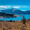
 Keystone, CO
As the Raven Flies
Keystone, CO
As the Raven Flies
4.1 mi 6.6 km • 649' Up 197.7 m Up • 632' Down 192.77 m Down
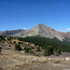
 Ptarmigan Peak
8.4 mi 13.6 km • 2,518' Up 767.38 m Up • 2,518' Down 767.58 m Down
Frisco Peninsula Long Loop
11.0 mi 17.6 km • 777' Up 236.92 m Up • 776' Down 236.38 m Down
Little French Loop
12.6 mi 20.3 km • 1,659' Up 505.65 m Up • 1,659' Down 505.53 m Down
Great Flume to the Colorado Trail
17.3 mi 27.8 km • 2,450' Up 746.74 m Up • 2,444' Down 744.84 m Down
Brecken…, CO


1 Comment