MTB Project Logo

See the best of both Hulls Gulch and Military Reserve with this grinder.


Your Rating: Rating Rating Rating Rating Rating      Clear Rating
Your Difficulty:
Your Favorites: Add To-Do · Your List
Zoom in to see details
Map Key

18.4

Miles

29.6

KM

95%

Singletrack

3,979' 1,213 m

High

2,801' 854 m

Low

2,521' 768 m

Up

2,518' 767 m

Down

5%

Avg Grade (3°)

21%

Max Grade (12°)

Dogs Unknown

E-Bikes Not Allowed

Overview

Classic Boise MTB - park and climb!

This one has plenty of up and down action. Huffing up a singletrack hill or bombing down the same, this one has both.

Need to Know

Basic Boise foothills singletrack. On hot days make sure you have plenty water. Always cede the right of way to the uphill riders.

Directional Trail: Part of this loop is on Lower Hull's Gulch Trail, which is directional based on the day. You can only ride downhill on Hull's as shown if it's an odd-numbered calendar day. On even-numbered days you can only ride up Hull's.

Description

Start at the Hull's Gulch Interpretive Center and go up Owl's Roost #37. A right onto Kestrel Trail will take you up to Crestline Trail. Take it to Sidewinder, then do Fat Tire Traverse, down Freestone Ridge, then back up the short lower section of Three Bears. Here is the first of 2 run down properties - Fred Sanford's place possibly. Climb this smooth trail up to Shane's Trail and do the clockwise loop. Drop back down on Bucktail Trail and down to the bottom of the canyon. Go left and down for a short distance until it's time to go up the Military Reserve Connection trail.

As you're huffing up that lovely trail, look down to the right to see the 2nd of the run down places, ostensibly Lamont's this time. Up the connector to Crestline Trail again. Head up Crestline Trail and try to beat your time up the short Kestrel hill up the trail a bit. Continue on Crestline Trail all the way to Lower Hulls Gulch Trail. Now take it in and roll down this sweet intermediate trail. When you arrive back at the interpretive center be sure to go across 8th street and go up Chickadee Ridge Loop - drop back down into the parking lot and you're done!

Contacts

Land Manager: Ridge to Rivers

Shared By:

Tyler Zundel with improvements by Graham Freeman and 1 other

Trail Ratings

  4.2 from 6 votes

#2301

Overall
  4.2 from 6 votes
5 Star
17%
4 Star
83%
3 Star
0%
2 Star
0%
1 Star
0%
Recommended Route Rankings

#79

in Idaho

#2,301

Overall
2 Views Last Month
5,888 Since Sep 6, 2014
Intermediate Intermediate

0%
0%
100%
0%
0%
0%

Photos

Delicious Snakey Berm on Sidewinder
Oct 22, 2021 near Boise, ID
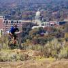
Parker threading it on the Hulls Gulch technical rock section.
Oct 31, 2015 near Boise, ID
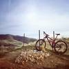
At the junction of freestone and fat tire.
Mar 30, 2020 near Boise, ID
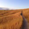
Golden hour in the foothills.
Oct 9, 2016 near Boise, ID
Top of Bucktail just before Shane's intersection.
Sep 9, 2016 near Boise, ID
Sunrise in Boise! At the top of kestrel on crestline
Mar 30, 2020 near Boise, ID

0 Comments

Weather


Current Trail Conditions

Unknown
Add Your Check-In

Check-Ins

Mar 17, 2021
Beryl Price
Aug 31, 2020
Bo Wilmer
Jun 10, 2016
Kris B.
19.5mi — 2h 16m
Welcome

Join the Community

Create your FREE account today!
Already have an account? Login to close this notice.

Get Started