
 Continue with onX Maps
 Continue with Facebook


 Intermediate

 Intermediate
Local Club: Hardscrabble Trails Coalition
Land Manager: BLM Colorado - White River Field Office
 Eagle Backcountry Tour
66.2 mi 106.5 km • 8,463' Up 2579.57 m Up • 8,460' Down 2578.75 m Down
 Wild Ridge Sample
5.1 mi 8.2 km • 979' Up 298.55 m Up • 978' Down 298.13 m Down
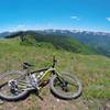
Avon, CO
 XTERRA Mountain Championship
15.7 mi 25.2 km • 3,118' Up 950.51 m Up • 2,444' Down 745.05 m Down
 Beaver Creek > Cinch > Corkscrew > Aspen Glade
8.0 mi 12.8 km • 1,843' Up 561.81 m Up • 1,844' Down 561.92 m Down
Son of a Buffehr
20.6 mi 33.2 km • 3,139' Up 956.83 m Up • 3,139' Down 956.9 m Down
Vail Big Loop: Climb to Two Elk DH and Back
30.8 mi 49.5 km • 4,080' Up 1243.54 m Up • 4,081' Down 1243.8 m Down
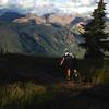
Vail, CO


 Minor Issues


1 Comment