
 Continue with onX Maps
 Continue with Facebook


 Intermediate

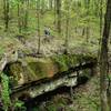
“An optional route when using roads to connect from the Archers Fork area to Duecher. ”


1.1
Miles1.8
KMDoubletrack
 Intermediate
Land Manager: USFS - Wayne National Forest Office
 Greenwood/Scenic River Trail Classic
12.9 mi 20.7 km • 1,085' Up 330.66 m Up • 1,087' Down 331.27 m Down

 Newport, OH
Wayne Mini-Epic
Newport, OH
Wayne Mini-Epic
25.4 mi 40.9 km • 2,647' Up 806.75 m Up • 2,647' Down 806.88 m Down
Newport, OH
Wayne National Forest Epic
34.8 mi 55.9 km • 3,227' Up 983.67 m Up • 3,256' Down 992.28 m Down
New Mat…, OH
 Bean Ridge/Bear Run Old School Classic
14.4 mi 23.2 km • 1,832' Up 558.51 m Up • 1,832' Down 558.45 m Down
Newport, OH
Pioneer Trail: Lamping Homestead to Marietta
62.6 mi 100.7 km • 6,473' Up 1973.08 m Up • 6,614' Down 2015.83 m Down
Woodsfield, OH
 North Marietta Tour
13.1 mi 21.1 km • 1,534' Up 467.52 m Up • 1,533' Down 467.38 m Down
Marietta, OH


0 Comments