
 Continue with onX Maps
 Continue with Facebook


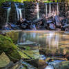
“Paved trail that can be used to connect the Rock Creek Trail and the Northwest Branch Trail. ”


4.7
Miles7.6
KMPaved Path

Land Manager: Montgomery County, MD - Parks
 Needwood Loop
20.2 mi 32.4 km • 652' Up 198.59 m Up • 656' Down 199.99 m Down

 Derwood, MD
 West Friendship Park
3.4 mi 5.5 km • 220' Up 67.07 m Up • 210' Down 63.96 m Down
Lake Accotink
4.8 mi 7.8 km • 245' Up 74.53 m Up • 235' Down 71.55 m Down
 Middle Patapsco
13.9 mi 22.4 km • 1,066' Up 324.87 m Up • 1,067' Down 325.35 m Down
 Chevy Woodstock Loop
6.4 mi 10.3 km • 361' Up 110.18 m Up • 358' Down 109.24 m Down
Randall…, MD
Laurel Hill
10.7 mi 17.3 km • 586' Up 178.64 m Up • 586' Down 178.71 m Down


0 Comments