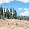
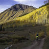
“This new addition to the South Rim trail casually winds its way around the southern most side of Signal Peak. ”
0.9
Miles1.5
KMSingletrack

Local Club: Gunnison Trails
Land Manager: BLM Colorado - Gunnison Field Office
 Signal Peak Loop
21.8 mi 35.1 km • 1,955' Up 595.95 m Up • 1,944' Down 592.57 m Down


 Gunnison, CO
 Hartman Southeast Loop
13.0 mi 21.0 km • 1,497' Up 456.18 m Up • 1,488' Down 453.5 m Down


 Gunnison, CO
 Reno/Flag/Bear/Deadman's Gulch
18.9 mi 30.4 km • 3,253' Up 991.47 m Up • 3,272' Down 997.32 m Down


 Crested…, CO
 Crystal Peak - Star Pass Big Loop
24.4 mi 39.3 km • 4,778' Up 1456.27 m Up • 4,780' Down 1457.08 m Down


 Crested…, CO
 Teocalli Ridge Loop
11.5 mi 18.5 km • 2,149' Up 654.94 m Up • 2,146' Down 654.1 m Down


 Crested…, CO
 Baxter Gulch Green Lake Loop
15.1 mi 24.2 km • 2,906' Up 885.77 m Up • 2,905' Down 885.59 m Down


 Crested…, CO


0 Comments