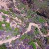
“The hardest way to ride down from Santiago Peak. ”
4.8
Miles7.8
KMSingletrack

Land Manager: USFS Cleveland National Forest - Trabuco District
 Harding-Joplin Luge
25.3 mi 40.7 km • 4,789' Up 1459.6 m Up • 4,792' Down 1460.57 m Down


 Portola…, CA
 The Luge Loop
7.7 mi 12.4 km • 1,227' Up 373.89 m Up • 1,203' Down 366.69 m Down


 Portola…, CA
 San Juan Lollipop
21.8 mi 35.1 km • 3,344' Up 1019.38 m Up • 3,344' Down 1019.13 m Down


 Coto De…, CA
 Whiting + The Luge
14.9 mi 24.0 km • 1,911' Up 582.61 m Up • 1,912' Down 582.85 m Down


 Foothil…, CA
 Tijeras Creek, Ladera Ridge, and Las Flores Ridge (Rage) Loop
8.6 mi 13.9 km • 875' Up 266.56 m Up • 873' Down 266.22 m Down


 Ladera…, CA
 Peters Canyon
5.6 mi 9.0 km • 376' Up 114.65 m Up • 376' Down 114.66 m Down


 North T…, CA


0 Comments