Dogs Unknown

E-Bikes
Unknown
Need to Know
To reach the start of the bike path, follow the Saint-Remy bike route signs starting at the Tarascon train station.
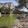
If you prefer to not ride right beside a fairly busy road, the small farm paths to the west are lovely and quiet. But only if you don't mind riding pavement.
Description
This trail allows you to ride from Tarascon to Les Alpilles hills on separated bike path. Once there, it's easy to get into the unpaved fire road network from the Chapel Saint-Gabriel to DFCI
Connector Trail.
The path is crushed gravel for much of its length, though you start out on a small paved road accessing a housing area, then pass through a paved parking lot and over a narrow pedestrian bridge before things settle out. There are a few stretches of dirt, as well.
You'll have to ride a few yards on the roadway at a round-about, and again where the path ends if you are going to the Chapel.
Shared By:
F Felix

 Continue with onX Maps
 Continue with Facebook


 Easy
Easy


0 Comments