MTB Project Logo

Super fun with lots of opportunity to get rowdy!


Your Rating: Rating Rating Rating Rating Rating      Clear Rating
Your Difficulty:
Your Favorites: Add To-Do · Your List
Zoom in to see details
Map Key

1.3

Miles

2.1

KM

Singletrack

2,370' 722 m

High

2,049' 625 m

Low

28' 9 m

Up

320' 98 m

Down

5%

Avg Grade (3°)

15%

Max Grade (8°)

Dogs Off-leash

E-Bikes Unknown

Need to Know

This area is also used by horseback riders. Please help maintain positive relations with horseback riders by observing proper etiquette and yielding the trail.

Description

A backcountry Pisgah experience with fast access from Hwy 321. Boone Fork Area is a condensed version of Wilson's Creek that is more easily accessed.

Ride Spencer Branch Rd. all the way until it ends in a meadow (4.25 miles from the parking area). Stay left. After a red clay rise, you'll see two entrances into the woods, both with a yellow blaze. Take the entrance on the left to begin this trail.

Yellow Trail follows the ridge with ups and downs along the way. On a steep up, Yellow Trail will fork off to the right and descend. Stay on the main trail (stay left) to begin Double H (Rhododendron's Revenge). After a short climb, Rhododendron's Revenge points down and stays heavy on the gas for a super rad blast that finishes with a tricky rut back to Spencer Branch Rd.

Contacts

Shared By:

Shawn Moore

Trail Ratings

  4.0 from 3 votes

#12435

Overall
  4.0 from 3 votes
5 Star
67%
4 Star
0%
3 Star
0%
2 Star
33%
1 Star
0%
Trail Rankings

#398

in North Carolina

#12,435

Overall
2 Views Last Month
255 Since Dec 30, 2018
Intermediate/Difficult Intermediate/Difficult

0%
0%
50%
0%
50%
0%

Photos

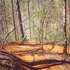
Trailhead is the 2nd yellow blazed trail to the left after you ride up a little steep red clay rise.
Aug 8, 2013 near Gamewell, NC
loading

Weather


Current Trail Conditions

Unknown
Add Your Check-In

Check-Ins

none
Welcome

Join the Community

Create your FREE account today!
Already have an account? Login to close this notice.

Get Started