
 Continue with onX Maps
 Continue with Facebook


 Intermediate

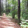
“Wide going up, narrower heading down. ”


0.6
Miles1.0
KMDoubletrack
 Intermediate
Local Club: Merrimack Valley NEMBA
Land Manager: Town of Burlington, MA - Conservation
 Best of Horn Pond Singletrack
5.1 mi 8.2 km • 353' Up 107.64 m Up • 353' Down 107.72 m Down

 Russel Mill - GBF Linkup
19.8 mi 31.9 km • 890' Up 271.15 m Up • 883' Down 269.2 m Down
 Carlisle, MA
Lowell-Dracut-Tyngsboro Route
Carlisle, MA
Lowell-Dracut-Tyngsboro Route
6.2 mi 9.9 km • 200' Up 60.96 m Up • 195' Down 59.52 m Down
Chelmsford, MA
Groton Town Forest Marked Loop
6.3 mi 10.1 km • 238' Up 72.45 m Up • 238' Down 72.39 m Down
Groton, MA
Beaver Brook Loop
8.1 mi 13.0 km • 554' Up 168.85 m Up • 572' Down 174.33 m Down
Spalding Park Town Forest Loop
5.3 mi 8.5 km • 454' Up 138.24 m Up • 453' Down 138.18 m Down


0 Comments