
 Continue with onX Maps
 Sign in with Facebook


 Intermediate

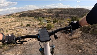
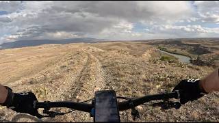
“Singletrack parallels the Gunnison River, occasionally on the edge of the bluff, with several extremely steep sections. ”


7.8
Miles12.5
KMSingletrack
 Intermediate
Land Manager: BLM Colorado - Grand Junction Field Office
 Holy Cross
2.7 mi 4.3 km • 159' Up 48.47 m Up • 511' Down 155.81 m Down

 Orchard…, CO
 Turkey Flats Loop
9.5 mi 15.3 km • 1,161' Up 353.97 m Up • 1,163' Down 354.52 m Down
Palisade Plunge: Complete Ride
32.0 mi 51.4 km • 839' Up 255.59 m Up • 6,814' Down 2076.97 m Down
Hard Earned Loops
37.8 mi 60.9 km • 3,658' Up 1115.08 m Up • 3,659' Down 1115.41 m Down
Loma, CO
Kokopelli Trail
143.4 mi 230.9 km • 13,447' Up 4098.75 m Up • 13,912' Down 4240.25 m Down
Loma, CO
Horsethief Bench
3.9 mi 6.3 km • 383' Up 116.71 m Up • 450' Down 137.05 m Down
Loma, CO


2 Comments