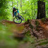
“One of the original segments of the Cross Charlotte Trail that runs through the dense forest along Mallard Creek. ”
4.8
Miles7.7
KMPaved Path

Land Manager: Mecklenburg County - Park and Recreation
 Harrisburg Municipal Park
3.0 mi 4.9 km • 224' Up 68.31 m Up • 232' Down 70.73 m Down


 Harrisburg, NC
 Fisher Farm Full Loop
4.3 mi 6.9 km • 291' Up 88.66 m Up • 292' Down 88.9 m Down


 Davidson, NC
 WWC East/North/South
16.6 mi 26.7 km • 1,096' Up 334.15 m Up • 1,078' Down 328.55 m Down


 Mount H…, NC
 George Poston Park
8.8 mi 14.2 km • 709' Up 215.98 m Up • 708' Down 215.9 m Down


 Ranlo, NC
 Poston Park
7.1 mi 11.4 km • 475' Up 144.76 m Up • 474' Down 144.6 m Down


 Ranlo, NC
 Mazeppa Park
4.9 mi 7.9 km • 258' Up 78.62 m Up • 261' Down 79.41 m Down


 Mooresv…, NC


0 Comments