MTB Project Logo

A steep and very technical ATV trail with almost no one on it.


Your Rating: Rating Rating Rating Rating Rating      Clear Rating
Your Difficulty:
Your Favorites: Add To-Do · Your List
Zoom in to see details
Map Key

5.1

Miles

8.2

KM

Doubletrack

11,085' 3,379 m

High

8,779' 2,676 m

Low

2,476' 755 m

Up

170' 52 m

Down

10%

Avg Grade (6°)

31%

Max Grade (17°)

Dogs Off-leash

E-Bikes Allowed

Need to Know

Please ride with caution as this is six of 500 miles of moto/ATV trail in a large area, and as such, maintenance is a bit stretched thin so deadfall is a very real hazard (I cleared 5 of 6 trees on the way up)!

Description

This is part of a moto/ATV network in the Wet Mountains. While some of the trails are moto-lated scree fests, this is not.

Lake San Isabel is the starting point if done as an out-and-back at 8,500 feet. It tops out at 11,088 feet and gains that altitude very quickly after the first 2.5 miles. From that point on, it's various combinations of steep, tech, loam, roots, and flow. This makes for a great deal of hike-a-bike for mortal men. This is a very exciting descent with two rough loose climbs to interrupt the fun. This would be a four or five star trail if not for them.

In hindsight, this would make a great shuttle as the descent burns altitude so fast that the climb was not balanced. That said, it's worth the effort as it rides like a steeper, rougher doubletrack version of Greens Creek off of the Monarch Crest. This is a great chance to hone your line choice skills as they will be tested as well as your ability to hold speed and brake wisely.

Contacts

Shared By:

Gregory Gehlhoff with improvements by Richard Hackett

Trail Ratings

  3.0 from 1 vote

#1

in San Isabel

#26145

Overall
  3.0 from 1 vote
5 Star
0%
4 Star
0%
3 Star
100%
2 Star
0%
1 Star
0%
Trail Rankings

#1

in San Isabel

#2,568

in Colorado

#26,145

Overall
1 Views Last Month
632 Since May 12, 2018
Very Difficult Very Difficult

0%
0%
0%
0%
0%
100%

Photos

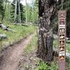
Open to motorcycles and e-bikes, but not OHVs.
Jul 16, 2020 near Colorad…, CO
Cisneros Trail No. 1314 is open to OHVs under 50-inches wide. Popular with hikers for the first couple of miles.
Jul 30, 2022 near Colorad…, CO

0 Comments

Weather


Current Trail Conditions

Unknown
Add Your Check-In

Check-Ins

none
Welcome

Join the Community

Create your FREE account today!
Already have an account? Login to close this notice.

Get Started