
 Continue with onX Maps
 Continue with Facebook


 Intermediate

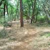
“A fun little singletrack with a few tricky spots. ”


0.8
Miles1.3
KMSingletrack
 Intermediate
Local Club: Weaver Basin Trail Committee
Land Manager: USFS - Shasta & Trinity National Forest Office
 Weaverville Basin - Jackass Ridge Downhill
12.8 mi 20.6 km • 1,616' Up 492.52 m Up • 1,615' Down 492.27 m Down
 LaGrange Classic Mountain Bike Race - Sport Course
26.9 mi 43.3 km • 2,984' Up 909.61 m Up • 2,991' Down 911.76 m Down
LaGrange Classic Mountain Bike Race - Intermediate Course
16.0 mi 25.8 km • 1,404' Up 427.93 m Up • 1,412' Down 430.44 m Down
 LaGrange Classic Mountain Bike Race - Elite Course
29.7 mi 47.9 km • 3,739' Up 1139.77 m Up • 3,750' Down 1142.98 m Down
LaGrange Classic Mountain Bike Race - Novice Course
8.4 mi 13.5 km • 774' Up 235.97 m Up • 783' Down 238.61 m Down
 The Chimney
10.1 mi 16.2 km • 1,863' Up 567.71 m Up • 1,864' Down 568.17 m Down


0 Comments