
 Continue with onX Maps
 Continue with Facebook


 Intermediate


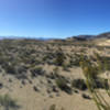
“Rocky jeep road with some challenging spots and great views. ”


9.7
Miles15.6
KMDoubletrack


0 Comments