
 Continue with onX Maps
 Continue with Facebook


 Intermediate


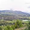
“A good climb with some heavy curves. ”


16.3
Miles26.3
KMDoubletrack
 Intermediate
Local Club: Pa' la Montaña
 The Route of Suesca
10.4 mi 16.8 km • 1,382' Up 421.12 m Up • 1,380' Down 420.63 m Down
 Guatavita
17.2 mi 27.7 km • 1,699' Up 517.73 m Up • 1,698' Down 517.56 m Down
BiciRegión: Ruta Caminos de Arcilla
39.1 mi 62.9 km • 5,238' Up 1596.48 m Up • 5,904' Down 1799.66 m Down
Villa d…, CO
La Vega - Nocaima
31.6 mi 50.8 km • 6,242' Up 1902.46 m Up • 6,253' Down 1906.02 m Down
 La Vega, CO
Circuito MTB Bogotá - Región
La Vega, CO
Circuito MTB Bogotá - Región
184.7 mi 297.2 km • 20,812' Up 6343.47 m Up • 20,808' Down 6342.36 m Down
Une, CO


0 Comments