
 Continue with onX Maps
 Continue with Facebook


 Intermediate

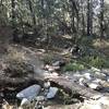
“A long moderate fire road climb up to the edge of the San Gorgonio Wilderness. ”


3.7
Miles5.9
KMDoubletrack
 Intermediate
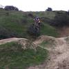
 Bike For Bender Hell Ride
35.9 mi 57.8 km • 2,349' Up 716.11 m Up • 7,055' Down 2150.22 m Down

 Big Bea…, CA
 South Shore to Santa Ana Loop
27.7 mi 44.5 km • 4,549' Up 1386.46 m Up • 4,549' Down 1386.45 m Down
 Cactus Flats OHV
5.8 mi 9.3 km • 535' Up 162.94 m Up • 536' Down 163.46 m Down
Lord of the Ridges Loop
6.2 mi 9.9 km • 790' Up 240.84 m Up • 793' Down 241.82 m Down
First Hump (Scott Ridge) Loop
2.7 mi 4.3 km • 374' Up 113.95 m Up • 382' Down 116.45 m Down
Pack Memorial MTB Trail
12.6 mi 20.2 km • 2,017' Up 614.63 m Up • 2,015' Down 614.29 m Down
Hesperia, CA


2 Comments