
 Continue with onX Maps
 Continue with Facebook


 Intermediate

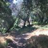
“A fun flowing descent away from the trailhead. ”


0.9
Miles1.4
KMDoubletrack
 Intermediate
Local Club: San Diego Mountain Biking Association (SDMBA)
Land Manager: USFS - Cleveland National Forest Office
 Noble Canyon Round Trip
18.9 mi 30.5 km • 2,435' Up 742.32 m Up • 2,440' Down 743.63 m Down

 Pine Va…, CA
Eagle Peak Out-and-Back
Pine Va…, CA
Eagle Peak Out-and-Back
9.0 mi 14.6 km • 1,933' Up 589.03 m Up • 1,933' Down 589.06 m Down
 Baja Divide: Section 2
80.3 mi 129.3 km • 5,645' Up 1720.73 m Up • 5,126' Down 1562.42 m Down
Tecate, MX
 Stone Mountain Trail
3.0 mi 4.9 km • 173' Up 52.77 m Up • 173' Down 52.68 m Down
Barnett Ranch Preserve Ride
4.9 mi 7.9 km • 258' Up 78.54 m Up • 259' Down 78.87 m Down
Rumorosa Downhill Shuttle
12.6 mi 20.2 km • 617' Up 187.91 m Up • 3,792' Down 1155.84 m Down
Cereso…, MX


0 Comments